GIS technology in public health
OUR GIS STRATEGY IN PUBLIC HEALTH FOCUSES ON THEMATIC MAPPING, SPATIAL ANALYSES, AND SPATIAL MODELING
We have applied GIS to support health facilities and services planning in all regions of Uganda by providing valuable spatial information to help make informed decisions.
Here are some ways that GIS has been applied in health facilities and services planning;
- Site selection: To help identify potential locations for health facilities, based on factors such as population density, demographics, transportation acess, and land use.
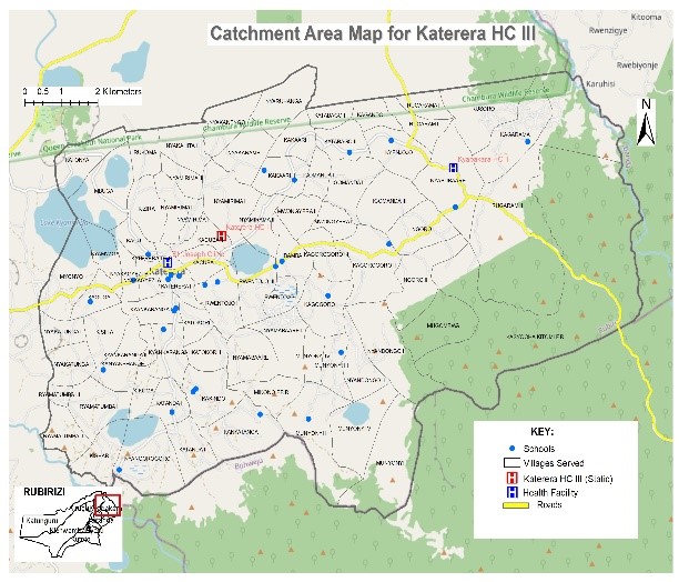
- Service area analysis: To analyze the coverage for the existing health facilities and services and to identify gaps in coverage. This helps in planning to determine where new facilities are needed and how to best allocate resources.
- Disease mapping: Mapping the incidence and prevalence of diseases, as well as the distribution of health risk factors. This information guides target interventions to areas with the greatest need.
- Resource allocation: To model different scenarios for the allocation of health resources, such as the number and location of health facilities, staffing levels, and equipment needs. To enable optimization of resource allocation to achieve the greatest impact.
- Emergency response planning: To support emergency response planning, by providing real-time information about the location and availability of health facilities, supplies, and personel in the event of a natural disaster or other emergency.
- Providing valuable insights for health facilities and services planning by enabling analysis and visualization of spatial data in a way that is not possible with traditionl data analysis tools.